Mapping streets, yards and areas of Lancaster that have been renamed or no longer exist
Click the image to go to the map…..
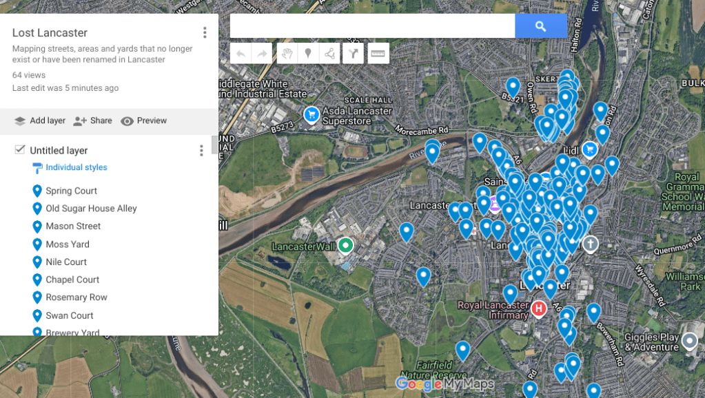
Lost Lancaster is a new resource to enable family historians and local researchers to easily track down the locations of almost 300 yards, alleys, places, courts, streets, lanes, terraces and roads and more that no longer exist in Lancaster. Each blue point shows the name of an individual location, how it was accessed and where available, a little extra background. Over time, extra information and photographs, where available will be added.
If there’s a location you know the name of, but don’t know where it was found- type it into map’s search bar and click the magnifying glass. Otherwise, enjoy exploring the map.
For any errors or places you think are missing, let me know and I’ll correct or add them.
